This is quite literally home territory for Kari and me. So we have visited more of the sites here than in any other. There are a number of people keeping track of the sites they have visited. In particular there are a couple of people that have visited all of the sites with structures as of 2013.
Of the sites with structures, Kari has been to more than 60 of them. Once again, we run into definition issues. On the Washington Coast page we see the AWS distinction. On this page, the Sauk Mtn and Excelsior Point sites had a structure on them when Kari visited with her family. Sauk was destroyed in 1991 and Excelsior in 1968. At this point we are not counting these as they are on no one's current list. Then there is Little Mtn behind Kari's childhood home. The structure up there is a non-historical one and there was an AWS structure up there until 1980. None of these are counted on teh Peakbaggers list.
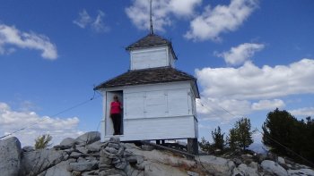
This region is also home of one of the hardest, technically, to get: Three Fingers Lookout. We tagged it Labor Day weekend of 2019.
Stats without AWS Adjustments
| Total Sites: | 97 | Sites with Structures: | 17 |
| Kari has visited: | 47 | Kari has visited: | 17 |
| Dave has visited: | 33 | Dave has visited: | 16 |
| Lookout Name | Kari | Dave | Comments |
|---|---|---|---|
| Anderson Butte | X | ||
| Bacon Point | 6 mi NE Marblemount, low elevation scramble. There appears to be about 3 mi of road plus a 250' elevation 'scramble' to this location Beyond this, there is very little information. 48.60104, -121.38026 | ||
| Baker Point | X | X | GPS Track A fire lookout site near Baker Lk. firelookout.com shows this to be at 2200', but we found debris (cables) at a spot near 2500' |
| Bannock Mtn. | 11 mi NE Glacier Peak, full scramble very difficult | ||
| Bare Mtn. Lookout | X | X | North Fork Snoqualmie Rd |
| Barlow Pass | X | X | Mountain Loop 48.03646, -121.44356 |
| Barometer Mtn. | 7 mi NE Mt. Baker, full scramble difficult | ||
| Basin | W of Spada Lk. Easy if access. Construction on dam in 2018 makes this very difficult. That construction dur to be complete in the summer of 2018. Might combine this with a kayak trip on Spada | ||
| Beckler Peak | X | X | Hwy 2 |
| Benchmark Mtn. Lookout | X | X | South of Glacier Peak, near the PCT |
| Black Rock Lookout | 17 mi NW Mt. Baker, Easy if Road access - long backroads drive? | ||
| Blackjack Ridge (ML) | 16 mi E Granite Falls, no mapped trails - full scramble One possible route | ||
| Blue Canyon | 11 mi ESE B'ham, Easy | ||
| Blue Mtn. | X | X | W of Spada Lk.
One possible route. Here is the way we did it May 2018. Logging in 2017 pushed a new road straight over the ridge. Not very attractive, but made finding the lookout site an easy navigational day, but a long hike. |
| Cady Point Lookout | 12 mi E Ross Dam | ||
| Canyon | |||
| Cascade Lookout | |||
| Church Mtn. Lookout | X | X | Mt Baker Rd. The top is nearly a scramble. There is a cable to hold onto. GPS Track |
| Circle Peak | |||
| Cleveland Mtn. | |||
| Constitution (structure exists) | X | X | On Orcas Island |
| Copper Mtn. (Ridge) Lookout (structure exists) | X | ||
| Crater Mtn. Lookout | |||
| Dan Creek G.S. | |||
| Darrington R.S. Lookout (structure exists) | X | X | The easiest one of them all! |
| Deming Lookout | |||
| Desolation Peak Lookout (structure exists) | X | X | Will attempt to backpack this in Jun or Jul of 2018. Accomplished! GPS Track See Below |
| Devils Dome | X | X | Kari and Dave did a 5 day backpack loop to this former lookout site. Here is a partial description. ... and the GPS Track. |
| Devils Mtn. Lookout | X | ||
| Dillard Point Lookout | X | ||
| Dock Butte | X | ||
| Easy Ridge Lookout | |||
| Entwhistle Mtn. Lookout | X | X | Near B'ham, do this with blue Canyon One possible route from Eric Wilhite. Here is my Track combined with Whatcom |
| Evergreen Mtn. Lookout (structure exists) | X | X | GPS Track |
| Excelsior Point Lookout | X | X | GPS Track |
| Finney Peak | |||
| Frailey Mtn. Lookout | X | ||
| French Point Lookout | |||
| Galbraith | |||
| Galena Mtn. | |||
| Gee Point | X | ||
| Glacier Ridge | |||
| Goat Mtn. | |||
| Goat Mtn. | |||
| Gold Hill | |||
| Granite Mtn. Lookout (structure exists) | X | X | GPS Track |
| Green Mtn. Lookout (structure exists) | X | X | Much of this track was done on snowshoes. |
| Haystack Mtn. (Gold Bar) | X | ||
| Haystack Mtn. (Sedro Wooley) | |||
| Heybrook Lookout (structure exists) | X | X | The Seattle Mountaineers runs it's Wilderness navigation field trip here. Kari and I have both taught that trip. Heybrook Nav Field Trip GPS Track |
| Hidden Lake Lookout (structure exists) | X | X | A special place for Kari's family. We will be caring for it the summer of 2018. Kari's webpage for this lookout |
| Higgins | X | ||
| Highrocks | |||
| Huckleberry Mtn. | |||
| Johnson Mtn. | X | X | Kari and Dave backpacked here via Pilot Ridge, a very long trek! GPS Track |
| Josephine Lookout | |||
| Jumbo Mtn. | |||
| Kodak Peak | X | X | |
| Little Mtn. (non historic structure exists) | X | X | Behind Kari's childhood home |
| Little Summit Lookout | X | ||
| Lookout Mtn. | |||
| Lookout Mtn. Lookout (Marblemount) (structure exists) | X | X | Hwy 20, near Marblemount |
| Maloney Ridge | X | ||
| McMurray | |||
| Miners Ridge Lookout (structure exists) | X | X | |
| Nooksack Lookout | |||
| Nordrum Mtn. Lookout | |||
| North Fork Bench | |||
| North Mtn. Lookout (structure exists) | X | X | GPS Track |
| Park Butte Lookout (structure exists) | X | X | A special place for Kari's family. Kari's webpage for this lookout |
| Persis | X | X | This site is not on the firelookout.com list, but others include it |
| Pilchuck Mtn. Lookout (structure exists) | X | X | Up the scramble route and down the trail and road to the Mtn. Loop Hwy GPS Track |
| Platts | |||
| Proffitts Point | X | X | A lowland fire lookout site on private land. We got close enough to photograph the site, but decided to respect the privacy requested. The site is between two existing powerline structures, there are "extra" concreat blocks visible from a distance that could easily be the remnants of a former lookout structure. GPS Track |
| Pugh | X | ||
| Red Ridge | X | ||
| Rinker Point | |||
| Roland Point | |||
| Samish | |||
| Sauk Mtn. Lookout | X | The structure on this site was destroyed in 1991. Kari visited this site multiple times before that time. | |
| Sauk R.S. (Lyle) | AWS Only? | ||
| Sawyer | X | X | |
| Si | X | X | Connecting Tenerife and Mt Si from the main Si parking lot. GPS Track |
| Snoqualmie Lookout | |||
| Sourdough Mtn. Lookout (structure exists) | X | X | GPS Track Kari's trip report |
| South Twin | |||
| Stillaguamish | |||
| Sulphur Point | |||
| Surprise Mtn. | |||
| Three Fingers Lookout (structure exists) | X | X | GPS Track |
| Whatcom Peak | X | X | GPS Track with Entwhistle |
| White Creek | |||
| Whitechuck Bench Lookout | |||
| Whitechuck Mtn. | |||
| Wickersham | |||
| Winchester Mtn. Lookout (structure exists) | X | X | GPS Track |
| Windy Mtn. |
Desolation Lookout deserves some elaboration. This is a simple trail once you get to the trail head. To get there, you must either hike a full day on the East Bank trail. Which is a very nice trail. Or arrange for the water taxi, which is a flat rate to the destination and is best split with up to six passengers. Either way, you must arrange for permits to camp at Marblemount. We elected to take the boat with 5 in our party and then stayed at Desolation Camp. There is only one water source part way up to camp, from there we melted snow. Do this in late June when the snow has melted enough to hike, but still enough to provide a water source.