The difference a bit of research will make.
I set out with a friend to do a snowshoe up the Mountain Loop Highway. The weather was iffy and we were not sure how far up th road we would need to go to find snow. It was more a social outing anyway so we grabbed a fist full of maps and a short list of possible destinations and off we went.
Our decision, as we the mountains on our drive started to turnwhite, was to try a loop hike on some snow covered roads up near Schweitzer creek. Loop hikes in the snow are exceedingly tricky as I explainedin an earlier entry in this series and this trip proved no different.We were trying to find a small unmaintained connector trail that would lead us from one road to another. We knew what we were looking forand it was marked on our paper map (Green Trails), but alas there was no sign of this trail.
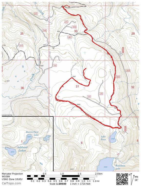
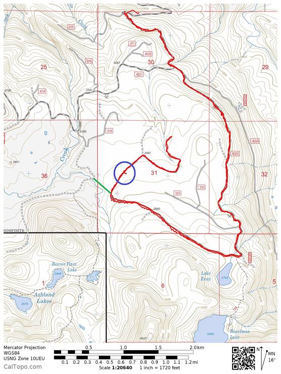
When I got home, built a picture of our route from my GPS track and superimposed it on one of the maps available to me on thecaltopo.com site as you see above. Then I took a closer look at this map and compared it to the paper map whilst sitting at my desk and I wasable to build up the picture you see below. The green line represents approximately where this connector trail should have been. Armedwith this information, it would have been easy to have dropped apredictive way point on my GPS the night before and I could have gotten us to within 10 feet of the trail. That and bearing for my compass that would have been easy to compute and I am sure we would have foundour way.
It also occurred to me later that I could have gotten a good approximation of the location of this trail by utilizing the UTMgrid on the paper map and manually entering this in as a way point on the GPS. But as I said, this was more a social outing, I was not up for using that much brain power on the problem so we chose to simply follow our footsteps back to the car. As it was we made it back just as the sun set and we had a very pleasant outing.
The lesson here is that just a bit of planning at the kitchen tablea day or two before is much more likely to get you where you aregoing. In this case, our lives did not depend on us closing this loop, buton some trips it might.
Update: We closed the loop
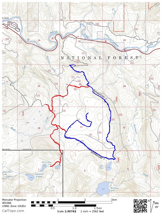
We went back another day and found the connector. Although unmarkedat the other side, it was much easier to find it's likely location. We didfind markers on the trees and finally at the other road a mostly buriedribbon to show the location of the trail.
If you compare the last two maps, you will see that the actualconnector trail was slightly Northeast of where I thought it would be.