If you have an interest in visiting fire lookout structures, Mt Rainier Nat'l Park is a great place to start. There are 4 in the park, Shriner, Fremont, Tolmie and Gobbler's Knob. They are all straight forward hikes on very well defined trails. There is nothing controversial with the Peakbagger's 93 list in this region.
Stats without AWS Adjustments
| Total Sites: | 72 | Sites with Structures: | 10 |
| Kari has visited: | 21 | Kari has visited: | 10 |
| Dave has visited: | 18 | Dave has visited: | 10 |
| Lookout Name | Kari | Dave | Comments |
|---|---|---|---|
| Anvil Rock Lookout | |||
| Bearhead Mtn. | |||
| Beljica | X | X | Kari and Dave hiked to Beljica and Gobbler's Knob on the same day. We camped at Lake Christine. GPS Track |
| Carbon Ridge | |||
| Cedar Point Lookout | X | ||
| Christoff Lookout | |||
| Clear West Peak | |||
| Collonnade Lookout | |||
| Colquhoun Peak | X | X | |
| Crawford Lookout | |||
| Crystal Lake | X | ||
| Crystal Mtn. Lookout | X | ||
| Deschutes Lookout | |||
| Electron Lookout | |||
| Fremont (structure exists) | X | X | |
| Garrison Hill | |||
| Glacier View Lookout | |||
| Gobblers Knob Lookout (structure exists) | X | X | Kari and Dave hiked to Beljica and Gobbler's Knob on the same day. We camped at Lake Christine. GPS Track |
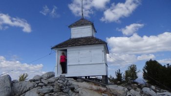
| Goodman Hill Lookout (structure exists) | X | X | A lookout structure on Ft Lewis property. It is possible to get to this site without going through a guarded gate, but beware! Here is the GPS Track See below for more information |
| Grass Mtn. | |||
| High Rock Lookout (structure exists) | X | X | GPS Track |
| Huckleberry Mtn. Lookout | |||
| Humphrey Mtn. Lookout | |||
| Hunters Cabin | |||
| Kelly Butte Lookout (structure exists) | X | X | |
| Kiona Peak Lookout | |||
| Kosmos Lookout | |||
| Ladd | |||
| Little Mtn. | |||
| Lookout Mtn. | |||
| Lookout Point | |||
| Lucas Creek | |||
| McClellan Butte | X | X | |
| McDonald Mtn. | |||
| McGuire Creek | |||
| Meadow Mtn. | |||
| Miller Hill | |||
| Mutton Mtn. | |||
| National Lookout | |||
| Newaukum | AWS Only | ||
| Nisqually | |||
| Noble Knob | X | ||
| Norse Peak | X | ||
| O'Farrell (South Prairie) Lookout | |||
| Ohop Lookout | |||
| Old Desolate | |||
| Pack Forest Lookout | |||
| Pinnacle Peak | |||
| Pleasant Valley | |||
| Porcupine Mtn. Lookout | |||
| Purcell Mtn. | |||
| Puyallup Ridge Lookout (structure exists) | X | X | 46.83419, -122.01721 This can be done as a snowshoe. Trip Report |
| Pyramid Peak Lookout | |||
| Rainier Tower Lookout | |||
| Rattlesnake Ridge | X | X | |
| Rockies | |||
| Saint Paul Lookout | |||
| Shriner Peak Lookout (structure exists) | X | X | |
| Snowshoe Butte | X | X | Unsuccessful attempt after tagging Stampede Pass.
GPS Track Successful tag: 9/8/18 GPS Track |
| Stahl Peak | |||
| Stampede Pass Lookout | X | X | There are two possible locations for this site. The GPS coordinates place it at a location marked on the map included with the GPS Track However, there is a location above it with a several buildings that seems more likely. We also tried to get to Snopwshoe butte on this trip. It was unsuccessful. |
| Sunset Park Lookout | |||
| Suntop Mtn. Lookout (structure exists) | X | X | Loop at the top, up the road and down the trail. The trail is recommended. The road might be easier to find and follow on a snowshoe trip, but the NW aspect could turn into a dangerous traverse if the snow is deep enough. GPS Track |
| Tatoosh Ridge Lookout | |||
| (East) Tiger Mtn. | X | X | |
| Tolmie Peak Lookout (structure exists) | X | X | |
| Tumac Mtn. Lookout | |||
| Watch Mtn. Lookout (structure exists) | X | X | 46.57086, -121.98762 South of Mt Rainer. GPS Track |
| West Fork Tilton | |||
| Weyerhauser No. 2 | |||
| Windy Knob | |||
| Windy Knoll |
The Goodman Hill GPS Track Zip File contains a couple of maps. The route closest to I-5, the red line on the maps, goes through a gate that is not always open. It was not when we tried it. You would have to try and call to find out when it is open. There was a sign on it that seemed to say it was open during certain hours. Good Luck with that! The blue line on the map did not pass any gates that even could be closed. So it would appear that route can be done at anytime. When you get to the southern end of the red line, on the east side of the lookout, it is still almost impossible to see. Get out of your car and walk to the west. Look up! The structure is very tall!